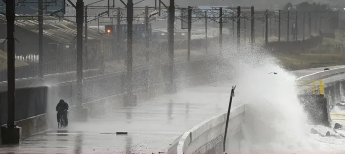
Scotland and northern regions brace for Storm Floris as 85mph gusts and travel chaos loom
Storm Floris is set to bring a wave of disruption as unseasonably strong winds sweep across large parts of the UK next week. The Met Office has issued a yellow weather warning for wind from 6am on Monday, cautioning that gusts of up to 85mph may hit exposed areas in Scotland and other northern regions.
The warning comes amid forecasts that the sixth named storm of the 2024–2025 season will track across the northern half of the UK, bringing dangerous conditions to millions. Inland gusts of 40–50mph are expected widely, with stronger winds of 60–70mph likely along coastal areas and high ground, particularly across Scotland. The possibility of 85mph gusts remains low but cannot be ruled out.
Storm Floris is expected to develop rapidly before making landfall, with the strongest winds anticipated on Monday afternoon and night. Although exact storm paths are difficult to determine at this stage, areas within the warning zone include Northern Ireland, Scotland, north Wales, and northern England.
The Met Office has warned that flying debris could pose a danger to life in affected areas. High waves and coastal spray may damage properties and roads near the sea, and loose tiles could be torn from rooftops. Power outages are also possible in the worst-hit regions, while transport networks are expected to face major disruption.
Roads, railways, airports and ferry services may all see delays or cancellations. Bridges in high-risk areas could be closed, and those planning to travel are urged to check conditions and adjust plans as necessary.
The full list of affected areas includes much of Scotland, with local authorities such as Aberdeen, Fife, Glasgow, and Edinburgh among those under warning. Northern Ireland counties including Antrim, Armagh, and Down are also on alert, alongside northern England authorities like Cumbria, Durham, and Northumberland.
In Wales, areas such as Gwynedd, Anglesey, and Conwy are covered, while Yorkshire regions including North Yorkshire, West Yorkshire, and York are also within the warning zone.
The Chief Meteorologist at the Met Office, Matthew Lehnert, said: “Across the warning area, many inland areas are likely to see gusts of 40 to 50mph, with 60 to 70mph more likely at higher elevations and around exposed coasts in Scotland. There is a small chance that some locations here could even record gusts of 85mph.”
Rainfall is also expected to accompany the storm, which could add to disruption, especially in areas where the ground is already saturated.
The storm’s timing in early August makes it unusual, as such strong winds are more typical of autumn or winter. Storm Floris follows a series of milder storms this year, but forecasters say this system poses a significant risk because of the combination of strong winds, potential power cuts and transport disruption.
Residents are advised to secure outdoor items such as garden furniture, bins, and loose decorations. Those living in coastal or exposed areas are especially urged to take precautions and avoid travel during the peak of the storm.
The Met Office will continue to monitor the system’s development and issue further updates as the situation evolves. Emergency services and local councils are on standby to respond to any incidents caused by the extreme weather.
With the school holidays under way and many people making summer travel plans, the timing of Storm Floris is particularly unwelcome. Authorities are asking the public to remain vigilant, plan ahead, and stay informed of weather developments throughout the weekend.
