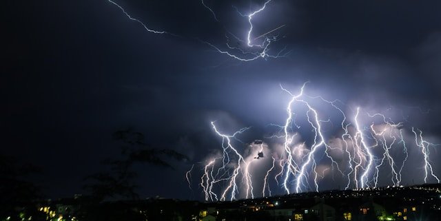
Severe thunderstorms spark life-threatening floods, power cuts and chaos across the UK
Britain is facing life-threatening weather this weekend as violent thunderstorms sweep across the country, triggering severe flood warnings and power outages. The Met Office has issued multiple weather alerts, warning of torrential downpours, large hail, frequent lightning, and dangerous winds.
An amber thunderstorm warning came into effect at 8pm on Friday, blanketing parts of East Anglia as well as eastern areas of East Sussex and Kent. The warning, which remains active until 5am on Saturday, highlights the risk of rapidly rising floodwaters that pose a “danger to life.”
Simultaneously, yellow thunderstorm warnings cover southwestern England and Wales until midnight, with an additional yellow alert activated at 7pm for East Anglia and the South East, lasting until 6am Saturday.
Embed from Getty Images“Fast flowing or deep floodwater is likely, causing danger to life,” the Met Office cautioned. Roads could quickly become impassable, homes and businesses may flood, and power outages are expected as the storms intensify.
Aidan McGivern, Met Office meteorologist, explained: “Initially, during the evening, it’s dry towards the South East but we’ll be watching developments over northern France very closely because that’s where these thunderstorms are likely to develop and drift northeastwards. The greatest risk of impacts lies across East Anglia and the far southeast of England — Kent, Essex, Suffolk, Norfolk — where we’re likely to see torrential rain, large hail up to 1-2cm in diameter, frequent lightning and gusty winds of 50mph or more.”
Motorists are urged to take extreme caution. Alice Simpson from the RAC warned: “Amber weather warnings must be taken seriously by drivers. Strong winds increase the chance of trees and powerlines falling and this combined with torrential rain over a short period can make driving much more challenging. Anyone not confident driving in the conditions may wish to postpone their journeys until the stormy weather passes.”
The Environment Agency echoed these concerns. Katharine Smith, flood duty manager, said: “Forecast heavy rain and thunderstorms today mean there is a risk of significant and localised surface water flooding impacts in parts of England, including the East and South East on Friday with impacts probable into early Saturday. Our teams have ensured rivers and watercourses are clear ahead of the storms and stand ready to support local authorities in their response.”
Smith issued a stark warning to motorists: “Do not drive through flood water. Just 30cm of flowing water is enough to move your car. People should check their flood risk, sign up for free flood warnings, and keep up to date with the latest situation.”
The dangerous weather arrives as the UK recorded its hottest day of the year so far. Santon Downham in West Suffolk hit 29.4°C on Friday, just edging past the previous 2025 record of 29.3°C recorded in Kew Gardens on May 1. Even Scotland experienced its hottest day of the year, with temperatures in Lossiemouth climbing to 25.7°C.
Despite the brief heatwave, forecasters expect more typical mid-June temperatures to return, with highs between 16-18°C in the north and 18-20°C in the south. However, the heat and humidity are fuelling what McGivern described as “very severe weather” overnight.
As emergency services remain on high alert, residents are urged to monitor updates and heed all official warnings.
