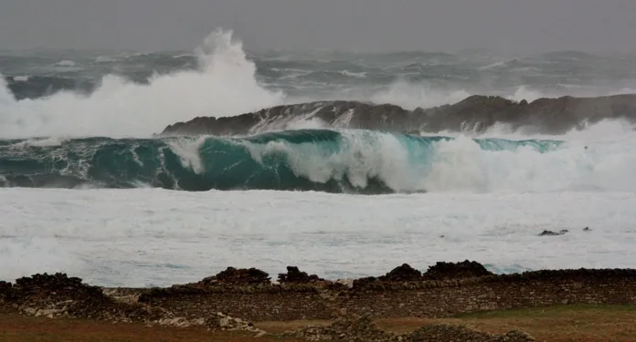
A decade after Storm Abigail, seventy named storms have shaped Britain’s weather awareness
Monday marks ten years since Storm Abigail became the first officially named storm in the United Kingdom. Abigail struck north west Scotland on 12 and 13 November 2015, producing gusts of wind that reached 84 miles per hour, which is 135 kilometres per hour. It was the beginning of a new chapter in how Britain names and responds to severe weather.
Since the introduction of the system in November 2015, the UK Met Office has worked with Met Éireann, the Irish weather service, and KNMI, the Dutch weather service, to assign names to seventy storms. Each September a new list of potential names is published to mark the start of the storm season that runs from autumn through to summer. In recent years members of the public have also been invited to suggest names for inclusion.
Before the naming system came into force, storms were generally remembered by the date on which they occurred. Examples include the Burns Day storm of 1990 and the St Jude’s Day storm of October 2013. Giving a storm a name before it arrives has proved to be an important tool for the media, weather agencies and the public when communicating the risks to life and property.
Will Lang, Chief Meteorologist at the Met Office, said that storm naming plays a crucial role in public safety. He explained that a name is not just a label but a way of helping people to understand, remember and discuss severe weather events.
Embed from Getty Images
According to the Met Office, the approach has been successful. When Storm Floris struck in August 2025, ninety three per cent of those living within the amber warning area were aware of the alert before it hit.
Over the past decade, several storms have stood out for their strength or destructive impact. Storm Eunice in February 2022 tore a section from the roof of the O2 Arena in east London. It was one of three named storms to affect the United Kingdom in a single week, alongside Storms Dudley and Franklin. Eunice triggered two rare red weather warnings and was regarded as the most severe storm to strike England and Wales since February 2014.
In January 2025, Storm Éowyn became the strongest windstorm in more than ten years. Red warnings were issued for Northern Ireland and parts of Scotland. The storm was named three days before its arrival, and the media was credited with raising public engagement and awareness of the warnings.
Not all named storms have been remembered for wind. Storms Bert and Darragh in 2024 and Storm Babet in October 2023 brought significant rainfall and flooding. Storm Desmond in 2015 remains notable for recording the highest daily rainfall of any named UK storm, reaching 267 millimetres.
Storms are named according to their expected impact. The Met Office National Severe Weather Warnings Service assesses both the likelihood of disruption and the potential damage to determine when a storm qualifies for a name. Severe weather warnings are issued in yellow, amber or red categories, using a matrix that evaluates both probability and consequence.
Although most storms are named for strong winds, rain or snow can also be decisive factors when the projected impacts are serious enough. Red warnings, the highest level, are reserved for events that pose a significant risk to life or cause major damage to infrastructure.
After ten years and seventy storms, Britain’s naming system has become an established part of public life. It has transformed technical weather reports into something people can relate to, understand and prepare for. For meteorologists it is a communication tool. For the public it is a reminder that every storm has a story and that awareness remains the best form of protection.
